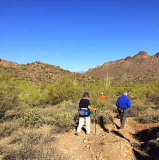
Both Hikes go to Hackberry Spring in a grove of trees at the base of the tall cliff for lunch. Then boulder scrambling up the beautiful canyon. Following the wash out of the canyon there is a right fork marked by a cairn going up a side canyon. It will come out at the corrals and windmill. Then continue south back up the wash to trail #236, turn right and go back to the trailhead.
Long hike: 6 miles, C+, Short hike: 5 miles, C
Driving Directions:
From the Junction of Hunt Highway and Highway 79, north of Florence, go north on highway 79 for 13 miles to highway 60. Turn left on highway 60 and drive three miles past King's Ranch. Just past Mountain View Road, bear right on
E Old West Highway. Turn right at the stop sign, then bear left continuing on Old West Highway to the first traffic light on Tomahawk. Turn right, going northward, past two stop signs, until you come to the junction of Highway 88. Turn right. Proceed past the Entrance to the Lost Dutchman State Park, to a signed road "First Water Trailhead". Turn right on this dirt road and proceed
2 1/2 miles, past a staging and parking area for horses and trailers, to the end of the road where there is a good parking area with pit toilets available.
See Link to Google Maps below:
Hackberry Springs - Google Map
Upcoming hikes:
Friday, Jan. 5.
Dixie Mine Trail, McDowell Mt. Regional Park. Petroglyphs,
Old Mine. 5, 7, or 8.4 mi.
Friday, Jan. 12
Romero Pools, Catalina State Park
Friday, Jan. 19
New! Yetman-Hidden Canyon Trails, Tucson Park


No comments:
Post a Comment